
Creating a Framework for GIS Mapping in Safe Routes to School
 As Safe Routes to School programs have increased across the country, a clear need for better data management at the national level has become apparent. Many communities have used Geographic Information System (GIS) mapping in assessments of the built environment, but because there is not a central place to store data, this information is stuck, in a sense, at the local level.

 The Safe Routes Partnership (Safe Routes Partnership) submitted
  A
A  Bicycle Awareness Month is drawing to a close, and I’ve been inspired by great
  The second annual Tennessee Bike Summit took place during May in Memphis, Tennessee. I had the pleasure of attending with a few hundred others from all across the volunteer state, who support bicycling as a form of transportation and recreation.
 Less than a month ago, President Obama announced that his choice for the next US Secretary of Transportation was Anthony Foxx, the mayor of Charlotte, NC. Based on his work in Charlotte and his remarks about transportation, we are hopeful about his potential to carry forward Secretary LaHood’s leadership on bicycling, walking and Safe Routes to School.
 Let’s Go NC!
 In March 2013, the American Diabetes Association released their most recent five-year update “
 Along with the transition from cold to a warm climate, more and more cyclists will be getting out to enjoy the beautiful sights the state has to offer.
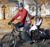
 Ever find yourself banging your head against the wall trying to advance a Safe Routes to School program across multiple schools or even an entire district? Worry not; there are plenty of other goose-egged foreheads (and dented walls) across the country that are in your same shoes.